The curlyleaf pondweed is an invasive species in the United States and is of particular trouble in the Upper Truckee River Watershed. Curlyleaf pondweed is a difficult species to control and will often outcompete native species in areas it invades. The following slides provide an in-depth look at the curlyleaf pondweed.
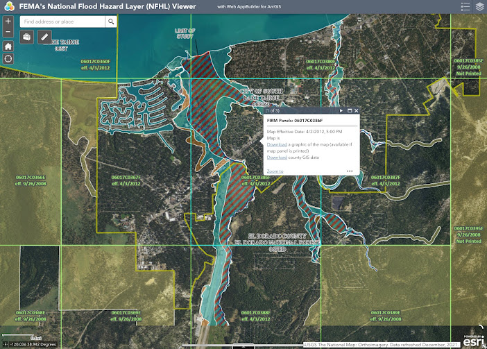
Floodplain Information: The area of the Upper Truckee River Watershed that I am analyzing is the area between the Upper Truckee River and Trout Creek. This area is known as the Truckee River Marsh area. One would think that an area situated between two bodies of water would be subject to flooding. However, as shown in the image below, this area is designated as FEMA flood zone X, which represents an area of minimal flood hazard (FEMA, 2021). Zone X has a 0.2 percent annual chance of flood (FEMA, 2020). Soil Data: This area of the Upper Truckee River Watershed is characterized primarily by Tahoe complex and Christopher-Gefo complex soils (USDA, 2019). Other soils include Watah peat and Marla loamy coarse sand. Tahoe complex soil occurs at 0 to 2 percent slopes, is found at elevations of 6,220-7,970 feet, has very poor drainage, and is not classified as prime farmland. Christopher-Gefo complex soil occurs at 0 to 5 percent slopes, is found at elevations of 6,220-6,410 feet, has g...
Comments
Post a Comment